
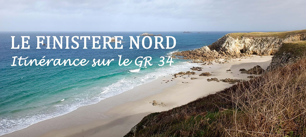
Hiking on the GR34 from Morlaix to Douarnenez
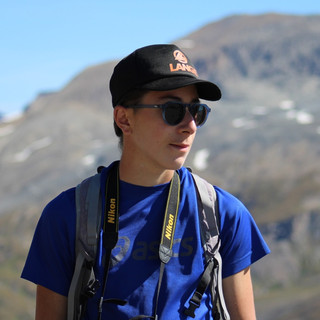
- Tom Jacquot
- Jan 23, 2025
- 11 min read
I suggest that you join me today for a hiking journey on the GR34 from Morlaix to Douarnenez, discovering the beautiful landscapes of Northern Finistère and the Breton coastline in France. In this article, you will find practical tips along with my personal account and feelings, to help you embark on your own journey along the Breton coastal trail.
Sommaire :
What is the GR 34?
- Map of the GR 34
The GR® 34, also known as the "Sentier des Douaniers" (Customs Officers' Path), is the longest Grande Randonnée trail in France, spanning approximately 2,000 kilometers along the entire Breton coastline. It connects Mont-Saint-Michel to Saint-Nazaire via the coast, offering countless sea views. This trail is rich in history and heritage.

- The Morlaix to Douarnenez section

From the Bay of Morlaix to Douarnenez in Finistère, the GR® 34 stretches over 500 km, closely following the Breton coastline and offering uninterrupted sea views. It takes between 25 and 30 days to hike from Morlaix to Douarnenez along the coast. The trail passes through the Pays de Morlaix and Léon, where the coastal area has been transformed into a coastal vegetable garden; the Côte des Légendes at the northwestern tip of Finistère; the Pays des Abers, with its Celtic-inspired landscapes; the Iroise region at the far west of Finistère, facing the islands of Ouessant and Molène; the Brest Terres Océanes area; and finally, the Crozon Peninsula within the Armorique Regional Natural Park.
- The FF Randonnée guidebook
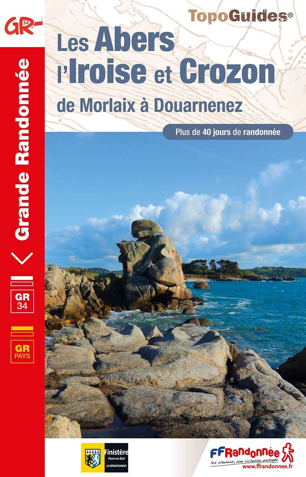

For this multi-day hike, I recommend purchasing the FFRandonnée guidebook "Les Abers, l’Iroise et Crozon", available online at https://boutique.ffrandonnee.fr/topoguide-les-abers-l-iroise-et-crozon and in various stores.
- Markings on the GR 34

The trail is very well marked with white and red markings, similar to all French GR trails. Along the route, you will also find time and distance indicators, as well as maps to help you adjust the stages as needed.
When is the best time to walk the GR 34?
The GR34 is accessible year-round; however, some sections can be very wet or muddy in winter. It is important to wear appropriate hiking shoes. I recommend embarking on this hike during spring, summer, or early autumn.
How do you organise your itinerary on the GR 34?
Planning your multi-day hike in advance is crucial to ensure you don’t forget anything and to avoid issues during the hike. Here, I will list some key elements to help you set off with peace of mind on the GR34.
- Planning your itinerary and stops
Before your departure, it is important to prepare your itinerary as well as the potential stages you will undertake. Of course, this is not set in stone and may be modified beforehand or during your journey (depending on your fatigue, weather conditions, etc.). Therefore, it’s not about planning every stage in detail, but rather about gathering information on accommodation, resupply options, and transport along the route. To plan your hike, I recommend using the OutdoorActive website or app, which allows you to view the map with various layers, search for an existing route, or create your own using the tool provided. This will give you an idea of the number of kilometers you want to cover in a day. At the end of this article, you will find the track of my route on the OutdoorActive platform, downloadable in .gpx format.

As I mentioned earlier, another essential tool for organizing your hike is the FFRandonnée guidebook. Inside this book, you will find all the information regarding the stages, the number of kilometers, accommodations, and resupply points near the trail. This guide is just as useful for preparation before the hike as it is during the hike itself. Yes, it adds extra weight to your bag (244 g to be precise), but you’ll find it very helpful, and you won’t regret bringing it along.
Finally, also use Google Maps to find all the addresses and contacts with just one click, and it’s free! You just need a bit of internet connection.
- Packing your backpack: the essentials

Another very important aspect of organizing a multi-day hike on the GR34 or any other trail is packing your backpack. It may seem trivial, but every gram counts, so it’s essential to bring only what’s necessary and avoid overpacking. I know, it’s always easier said than done. That’s why I will list here some key items that, in my opinion, should not be forgotten for your hike.
A first aid kit: survival blanket, scissors, gauze, small bandage, elastoplast (adhesive bandage).
Bring two liters of water; water can easily be found in villages (cemeteries, fountains).
Bring freeze-dried food (3-4 packets) in case of emergency; carbohydrates: quick-cooking pasta, rice, couscous, etc.; chocolate muesli for breakfast with powdered milk (very compact in a Ziploc bag); ham, sausage, a small piece of cheese; cereal bars for a snack during the hike. Don’t bring too much, as you can easily buy the rest in one of the villages the trail passes through.
It’s important to pack warm and waterproof clothing, even if it’s summer, especially if you plan to camp, as nights can be chilly. If possible, try to avoid packing heavy and bulky clothes like your ski fleece, and instead, opt for lightweight and compact clothing. Here, I will list some of the clothing I use, along with links to the online stores where you can view their features.
A breathable merino wool t-shirt: Merino wool is a very soft and flexible material that helps prevent sweating and retains odors. Personally, I’m a fan of the Icebreaker brand for the quality and durability of their products. Icebreaker merino wool t-shirt.
A warm and lightweight fleece: Having a fleece is essential to protect yourself from the cold during the day and in the evening. Warm and lightweight fleeces - product comparisons.
The hiking pants are, of course, an essential piece of clothing for your multi-day hike. For my part, I invested a few years ago in this model from the Forclaz brand, and I’ve been very satisfied with it so far. Forclaz hiking pants.
During a long multi-day hike, you’re never safe from bad weather, especially rain, so it's important to be prepared! After much thought and hesitation, I decided to go for a rain jacket and rain pants instead of a rain cape. Let me explain my point of view. In my opinion, a rain cape takes up much more space in a backpack and is less practical for hiking (especially in windy conditions). Additionally, the rain cape doesn’t protect the lower legs, which can lead to water seeping into your shoes. Here are some examples of rain jacket and pants:
You will find a link below to download my standard camping checklist in Excel format. Of course, this is a personal list and may not be directly applicable to your needs. It’s important that you adapt it by considering your own requirements.
- Check the days and times of the tides
The last key point I wanted to mention. Before venturing onto the coastal trail, it is crucial to check the tide schedules and avoid certain sections during high tide episodes. It’s better to take a detour than to take any risks. To track the tide changes on your smartphone, I recommend the "Marée" app, which is very easy to use and available offline.
Where to stay while touring the GR34?
Several options are available to you when it comes to finding accommodation for your multi-day hike on the GR34.

You likely want to do part or all of this hike with wild camping, and there are certainly some beautiful spots to pitch a tent with a sea view. However, wild camping is regulated and not allowed everywhere along the trail. Make sure to check the regulations in place depending on the locations and the period during which you plan to hike. For example, wild camping is prohibited throughout the Armorique Regional Natural Park. It would be a shame to get fined during your vacation!

You can also opt for campsites, which are usually open from April to September, and you’ll find them easily along the trail. Be aware, however, that if you’re hiking in October as I did, very few campgrounds are still open, so make sure to check in advance before starting your hike. For a tent pitch in a hiker’s package, you’ll generally pay between €10 and €15 per night.
The third option available to you is staying in hostels & youth hostels. It’s a great way to get a good night’s sleep on a comfortable mattress, and most of the time, they also offer breakfast. This will help you recharge without breaking the bank, usually costing just over €25. Check with the Ostal youth hostels in Morlaix, the Île de Batz (more details in my story), and Brest; as well as with the organization "La Route des Pingouins," which includes hostels along the Finistère coast.


A small aside: don’t hesitate to ask the locals if they know of any places to sleep or pitch your tent. You’re likely to find that they’ll offer you a patch of land. After all, nothing ventured, nothing gained, right?
Where to refuel on the Breton coastal path?

Another essential aspect of the multi-day hike is resupplying with water and food. The advantage of Brittany is that there are villages scattered along the trail. You’ll easily find water at a fountain or near the cemetery. As for food, not every village has a convenience store, so make sure to check the guidebook for places to stock up on supplies.
The story of my itinerary on the GR34
I left Chambéry by bus heading to Morlaix, with a stopover in Paris Bercy. Tired from the journey, I spent my first night at the Morlaix Youth Hostel, where I took the opportunity to recharge before starting the hike. Then I began my journey heading west. I alternated between wild camping, campsites, and hostels I found along the way. I did most of the route on foot, hitchhiking on some sections to make progress on stages during bad weather or when I was too tired.
After leaving the town of Morlaix, I followed the trail along the Bay of Morlaix to Carantec, where I spent the night at the Kerlaudy campsite. The beginning of my journey was difficult. I experienced the stress of solitude, even though that was the very reason for my departure. It must be said that the weight of my backpack didn’t help my morale; the 15 kg I was carrying caused back pain.

The following day, I didn’t let myself get discouraged and continued my journey toward Roscoff, passing through the village of Saint-Pol-de-Léon. During this hike, I felt the need to escape to an island to recharge and enjoy the fresh sea air. So, I decided to take the boat from Roscoff to the Île de Batz to spend a few days there. The crossing takes about fifteen minutes, and the boat runs frequently. On the island, I stayed at the youth hostel, which is just a few steps from the ferry terminal and the botanical garden, set in a natural setting with a stunning view of the coastal landscape and the English Channel. Whether in dorms, in a cabin, or even camping, there are several accommodation options available. You can also request breakfast in the morning and enjoy the chef’s cuisine in July and August. A self-catering kitchen is also available for your use. I appreciated the calm and tranquility of the place, especially since we were the only two guests in the hostel at that time. I highly recommend this spot and thank the entire team for the warm welcome and helpful information during my stay.

The following days allowed me to explore the island, spending each day discovering the beauty of its landscapes. I had left most of my belongings at the youth hostel and only took a picnic and a bottle of water in a smaller bag to ease the strain on my back. In the evenings, I took the opportunity to enjoy a crepe while watching the sunset. After all, it’s important to treat yourself! I spent my final moments on the Île de Batz admiring its 71-meter-high lighthouse. I highly recommend visiting this island if you ever have the chance.

The next morning, I took the boat shuttle back to Roscoff to continue my journey on foot heading west. At high tide (coefficient above 80), after the Santec State Forest, the sea covers the causeway, and a detour of 2.6 km is required. I continued my walk, bypassing the Anse du Guillec, and spent the night at the Moguériec campsite.
GPS coordinates of the campsite: 48°41'13.3"N 4°04'35.7"W

The next day, I continued west along the coast to reach a beautiful wild camping spot at the Pointe de Poulfoën:
48°41'19.7"N 4°10'07.3"W

In the following days, I continued my journey on the GR34 in wild camping mode, following the coast. The trail then leaves the Morlaix and Léon regions to explore the stunning landscapes of the Côte des Légendes: the Bay of Kernic, the Ker Emma dunes, and the Meneham site—places rich in history and traditions.
Here are the GPS coordinates for wild camping spots along this section of the GR34:
Beg ar Groaz: 48°39'51.7"N 4°17'47.5"W
Wild camping on private land in Vougo, the commune of Plouguerneau.

After crossing the Côte des Légendes, I continued through the Pays des Abers, with the towering Île Vierge lighthouse in my sights. This lighthouse, at 82.5 meters, is the tallest in Europe. The trail moves away from the coast to loop around the Aber Wrac'h and Aber Benoit—although it may not seem like it, that adds up to quite a few kilometers!
Here is the GPS coordinate for a wild camping spot in the Pays des Abers:
Landéda: 48°36'14.1"N 4°35'57.4"W
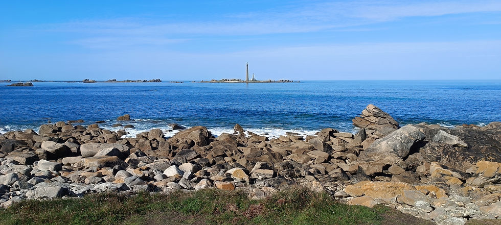
After the Pays des Abers, the trail crosses the Iroise, at the far western tip of Finistère, with its many lighthouses and views of the islands of Ouessant and Molène. A must-see stop is Le Conquet and the Pointe Saint-Mathieu with its lighthouse. I find this place simply magical—the landscape is breathtaking, and I will never tire of it.
Here are the GPS coordinates for wild camping and a gîte d'étape along this section of the GR34:
Lampaul-Ploudalmézeau: 48°34'06.5"N 4°39'32.0"W
Plouarzel: 48°24'49.1"N 4°47'33.4"W
Wild camping at a local’s place in Plougonvelin.

As you’ve probably guessed, I’m an avid fan of islands. I wanted to visit the Île d’Ouessant, but I left it too late to book accommodation, and it also happened to be a weekend. So, I gave up on the Ouessant plan and decided to head to the Presqu’île de Crozon instead. After passing Pointe Saint-Mathieu and before entering Brest, I decided to hitchhike to bypass the city and get closer to Crozon-Morgat, where I had booked accommodation for the next three nights. I stayed in an Odalys vacation rental. It wasn’t fantastic, but it worked out fine, especially since I only used it to eat and sleep, and it wasn’t too expensive. Here’s the link to the accommodation in case it might interest you: Résidence Odalys Crozon-Morgat.

These few days allowed me to explore the Presqu'île de Crozon on day hikes. I think at that point my back thanked me! I was able to tour the Pointe des Espagnols to the north, with its many ruined forts; the Pointe de Pen Hir to the west, with its famous "tas de pois"; and then the Cap de la Chèvre to the south, which is actually my favorite part, the wildest of all, with a stunning view of the Baie de Douarnenez and the Pointe du Raz. Be careful though, the trail leading to Cap de la Chèvre is steep, so you need to watch your footing! After spending these three nights on the Presqu'île de Crozon, it was time for me to finish this journey, to spend my last day on the coastal trail, and to reach Douarnenez, where part of my family was waiting to meet me for the occasion.

My feelings about this experience in Finistère
This walking journey along the coastal path taught me a lot about solo hiking and helped me refocus on what is essential in my life, my well-being. I was also fortunate to meet many people who inspired me and enriched me from a human perspective. It’s true that it wasn’t always easy—my tired back, a dip in motivation, the feeling of loneliness—but it was worth it. I set out on this trail without any specific goal or objective, with a sense of excitement about the unknown, the surprises the journey would bring. I simply came to have a good time for myself, with myself, without rushing, but rather respecting my own pace. I hold a precious memory of this experience, which I hope will serve as a model for many others in the future.
Hiking sheet & GPX track
Here is the route sheet I created for the GR 34 from Morlaix to Douarnenez, available for download in PDF format, along with the trace of my route on the OutdoorActive platform available for download in GPX format.


Comments